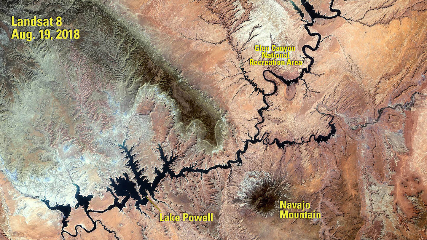
The image was taken by Landsat 8. Source: U.S. Geological Survey’s National Land Imaging Image Collections.
This image of Lake Powell was taken in 2018 following a period of drought that began in 2000. When the water volume was measured five months later, it was less than half of what the lake can hold. Powell is a reservoir, formed in 1963 when the Glen Canyon Dam was built on the Colorado River. It lies primarily in Utah, with its southern end at the dam in northern Arizona.