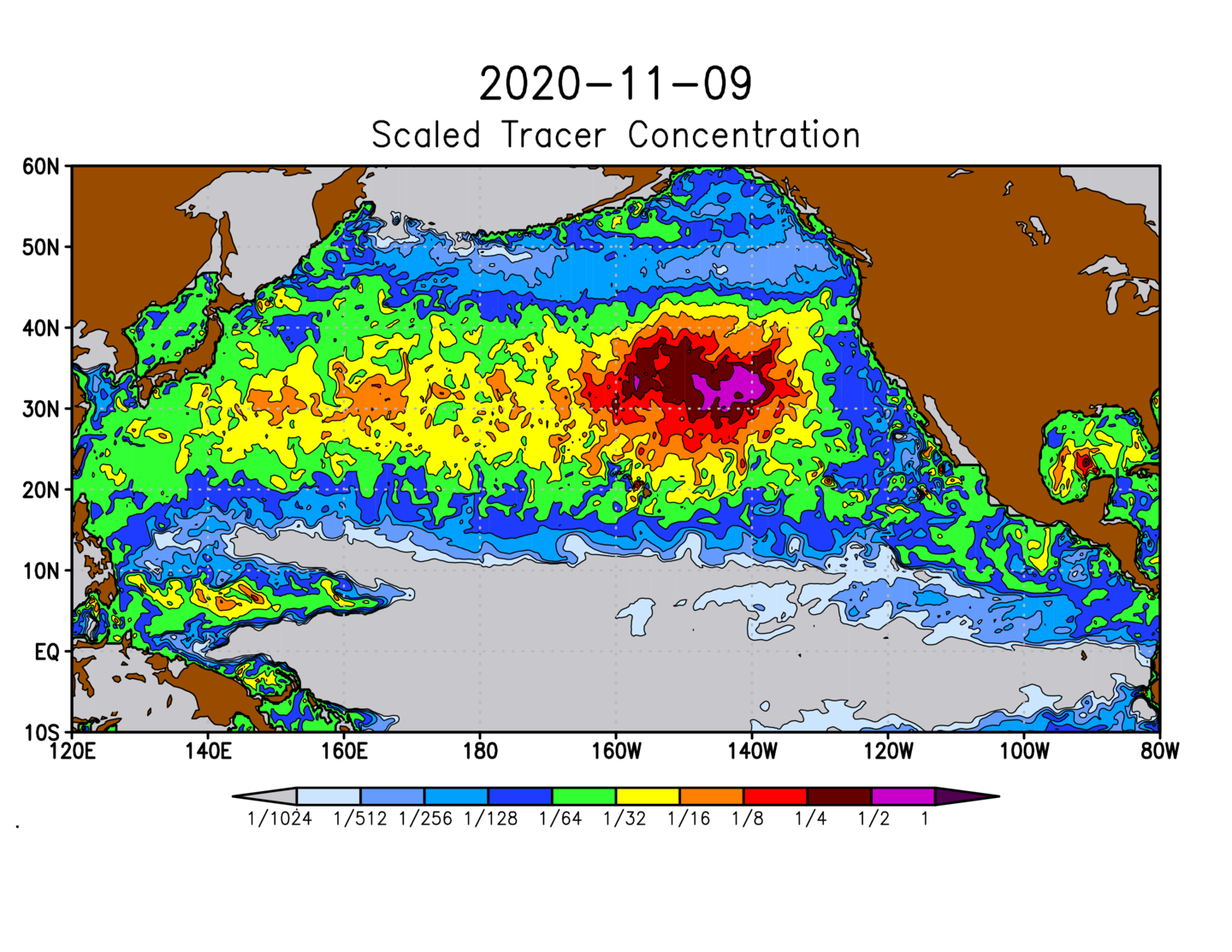
Because of the complex dynamics of the upper ocean, surface currents are hard to measure with satellites or derive from equations. To mitigate these problems, a team at the International Pacific Research Center, University of Hawaii, developed a diagnostic model called SCUD (Surface CUrrents from Diagnostics), based on historical trajectories of drifting buoys. They noticed that the majority of debris is trapped in “garbage patches,” where it may remain for many years. After experiments and calculations, new maps are now produced daily. The main feature on these maps is the large garbage patch area, and they show marine debris that is mostly submerged below the surface. Red colors correspond to higher probability of finding debris; blue colors indicate lower probability. The maps were used to coordinate cleanup expeditions conducted by the California-based Ocean Voyages Institute in 2019 and 2020. A project is underway to scale the model to practical units (such as the number or mass of debris items per unit area of the ocean), which will also allow the global balance of marine debris to be estimated.
