The Earth From Space: Derek Posselt
Curator Jay Belloli interviews Derek Posselt, Atmospheric Physics and Weather Group, Earth Sciences Section, NASA, JPL, Caltech.
Jay Belloli: How did you become interested in atmospheric science?
Derek Posselt: I’ve always been interested in science from a very young age and, in particular, the way the natural world works. When anyone asked me what I wanted to be when I grew up, I remember I would tell them that I wanted to be a scientist, even though I didn’t really know what that was. In my studies, I gravitated from the bottom up. I started in geology, dabbled a bit in hydrology, and then became fascinated with the atmosphere.
JB: Was this in your undergraduate degree at the University of Wisconsin at Madison?
DP: Yes, that’s correct. My Bachelor’s and Master’s were both in atmospheric science. But I did take a lot of coursework in geology, geography, and hydrology at the same time because I was interested in the other components of the natural systems as well. And after finishing my Bachelor’s and Master’s, I went to Colorado State University to get my Ph.D., also in atmospheric science.
JB: Your work for a long time has been on cloud systems, including tropical cyclones and clouds systems over mountains. How did you become interested in these areas of atmospheric study?
DP: I’ve been interested in how the weather behaves for quite a long time. Most dynamic weather involves clouds and precipitation. So, I became interested almost immediately in cloud systems; dynamic weather systems that involve wind, clouds and rain. I was fortunate enough to work with people at the University of Wisconsin who were experts in snowstorms. That’s where I got my beginnings. Then I became more interested in a wider variety of weather systems. During my Ph.D., I expanded from snowstorms into tropical weather. I became interested in thunderstorms and convection. In my career I’ve gone where my curiosity has led me. When I was a professor at the University of Michigan, I was fortunate enough to work with several talented graduate students, and I gave them the freedom to follow their interests. In partnership with them, I continued working on snowstorms, tropical convection and hurricanes, clouds in the Arctic, and also clouds over the mountains. I have been fortunate to work in many different areas, but they’ve all involved clouds and rainfall in the Earth’s climate system.
JB: How did you wind up at the Jet Propulsion Laboratory?
DP: I reached a the point in my career where I was looking at the next ten years, and I had an idea of the work I still wanted to do. I was very much enjoying my teaching position at Michigan. But I wanted to move to an institution that gave me access to people who were operating at the forefront of the development of new Earth system observations. JPL is a unique place in terms of the expertise and the disciplines that are represented there. For almost every part of the climate system you can imagine, from the ice caps to the oceans to the land surface to the atmosphere, there is someone at JPL who knows something about it. When I thought about the research that I wanted to do in the next decade, JPL was a great place to intersect with some of the most cutting-edge ideas being put forward.
JB: When I interviewed JT Reager, I found out that Earth science was the largest program at JPL. I hadn’t known that. You’ve learned a lot about cloud behavior over your last eighteen or nineteen years of experience. What have you learned?
DP: One of the first things I learned in studying cloud systems is that you have to deal with an immense range of space and time scales. Any time you consider any type of cloud system, crucial interactions and processes happen at the microscopic level. At the same time, cloud systems affect the climate of the entire planet over tens of thousands of kilometers. There are time scales that range from a fraction of a second all the way up to centuries. The complexity of the clouds themselves, and the details of their interactions across space and time still continue to impress me. In addition, the more I have looked at how clouds respond to changes in climate, the more I see how crucial clouds are to the flows of energy and water.
Consistent across just about every type of cloud system that we have studied is the fact that, if you increase the temperature, precipitation and cloud dynamics change. They change in similar ways. As the temperature increases, there is more water vapor available for formation of clouds, and rainfall gets more intense. Over nearly every region on the planet, the motions inside of clouds that control precipitation get more intense. This is true of thunderstorms, tropical cyclones, and mountain precipitation. There is a consistent set of physical laws that work across just about any system we have studied.
JB: What are the differences, then, in all the cloud systems you have studied?
DP: A lot of the differences have to do with changes in the scales of space and time. Clouds that occur on smaller spatial scales tend to be more sensitive to the small-scale details of the surfaces over which they form. For example, individual thunderstorms form over the United States in the summer. Where they form and how strong they are is sensitive to the fine-scale details of the land surface below them. A farmer can plow a field, which creates a dark area that was previously light. This dark surface heats up during the day, more than the lighter areas around it. This small local change in the surface temperature can affect whether or not a thunderstorm develops there the very next day.
Something large-scale like a winter storm or a tropical cyclone is different. There are still some subtle interactions, but the effects take longer. Sometimes it requires a change over the scale of an entire ocean basin to affect the behavior of a winter storm or a tropical cyclone. So scales of time and space really matter.
JB: Are there also subtle changes in the development of clouds over mountains?
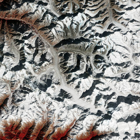
DP : One of the things we care most about in terms of mountain precipitation, especially in the Western United States, is whether the precipitation will fall as rain or snow, because snowpack is the major contributor to our water supply. The distinction between rain or snow depends a lot on the temperature of the air, and its moisture content, as it’s coming in over the coast. For example, we’ve done some experiments lately where a change in temperature of 2-degree Celsius, or 3 to 4 degrees Fahrenheit, can raise the snow level by a few thousand feet. If you think about the entire Earth system, even small changes to the ocean circulation, or the ocean temperature off the West Coast, impact the environment in which the storms form. Some of the storms themselves are so large that they may not be affected by very small variations in their environment. But a small change in the carrying capacity of water and temperature structure can change whether rain or snow falls in the mountains. And of course that has a huge effect on our water supply.
JB: Since the atmosphere is warming and can contain more water vapor, what effect does that have on clouds, if any
DP: That is one of the biggest and most important questions that we’re addressing right now in climate and climate change as we warm the planet. Evidence has conclusively shown that the planet as a whole is warming. That first effect of an increase in temperature is more water vapor in the atmosphere, and clearly that’s going to translate in differences in clouds. The challenge is trying to figure out exactly how that is all going to pan out. The most direct effect of more available water vapor is more rainfall. But where that rain falls, how intensely it falls, and at what times of year it falls are open questions. Global scale changes are relatively straightforward to understand. But they translate pretty quickly into very complicated regional changes that we still really don't understand.
Generally speaking, as I said earlier, one effect that we have seen consistently across every cloud system is, the more water vapor in the air, the greater the amount and intensity (amount per unit time) of precipitation. And the spatial regions where rain falls get smaller. So we have less gentle rainfall and more intense rainfall, which seems to be a pretty clear signal of climate change.
JB: Do I understand you correctly that the storms will not extend as much as they did because of the heavy downpours?
DP: That does seem to be what we’re seeing. This is something that people have been noticing for some time in the agricultural regions in the United States, partly in California but much more over the Midwestern states. With climate change over the last few decades, rainfall appears to become more sporadic and more intense, with fewer of these sustained light rain events that cover large regions. We get more events that are more focused and intense. And that makes a difference in the ability to grow crops. You can see examples where, over the scope of a single farm, you will see some fields that are flooded and others that are in drought. Both extremes are a challenge to farmers.
JB: You have had a lot of experience developing system models with NASA Goddard, as well as satellite programs and applications. Please tell me what it’s like to develop a systems model, and about the satellites you’ve used and helped develop.
DP: That’s a great question. All these activities are more closely related than you might think. In fact, the development of models and of new observations really go hand in hand. And in history of these developments in the United States and elsewhere, we have these cycles where the models sometimes will outpace the observations. This means that the models are so complex that we do not have observations we can use to test them. Sometimes the observations will make a leap forward, and we discover new processes or previously unknown deficiencies in our models. We implement in the models the new knowledge we learned from our observations. This has been a leap frog process that has been operating for quite some time. Anytime we take an observation, we have the potential to learn something new. And almost immediately we start to ask whether or not our prediction models are actually consistent with what we now know about the Earth’s system. Over time, as we observe, test, develop, and test again, we have developed prediction models that encompass the best knowledge we have of how the Earth’s system works.
For example, for quite some time we have made observations of clouds from space, and in the early days we were only able to see where the clouds were and what was happening at their tops. Soon we were able to see infrared images of clouds – their heat signatures – and we were able to see how tall the clouds were. Though this showed us the boundaries of clouds, we had no idea globally what was happening inside them. Some of the most exciting developments have happened in the last few decades. We’ve started to launch new space radar missions that probe the interior of clouds to see what is happening inside, and how they are developing – where the rain is, where the snow is, and the spatial extent of the rainfall inside. A good analogy is when you go to visit the doctor, and he or she does a visual inspection of your body using various tools. When the doctor uses a CAT Scan or MRI, you get far more information.
As we’ve gotten more and better observations of the interiors of clouds, we can take those observations to our prediction models, and ask questions about whether those models are actually producing the right kind of cloud structures. We fold that information in, and we make those models better. But honestly, one of the things that have made our models better have been advances in computation. We can do more with computation than we could just a few years ago. As our computers get faster and more powerful, we can run more detailed models with finer spatial scales and more complicated processes. And every time we do that, we need to confront the new models with new observations, so that the two are very closely linked.
What we now can do more and more often, and have been wanting to do for some time, is to tie the entire Earth system together in one unified collection of models. Typically we’ve run simulations of the ocean separate from those of the atmosphere, even though we know they interact with each other. It’s the same with the models of the land surfaces and of the ice sheets. So in the next five years increasingly we are going to see combinations of all those model components used for weather scales all the way up to climate. And it is already happening.
JB: That’s remarkable. That is exciting.
DP: It’s an exciting time to be in science. Tremendously interesting things are happening. We are learning so much.
JB: I have a question for you. Developing the models requires mathematics. I tried to understand Bayes’ theorem of probability. Please talk about the development of these models, which I’m sure involves probability theory.
DP: There are a couple of topics I can touch on here. First, any time we develop a model, we want that model to represent our best understanding of the way the world works. Now, that understanding is encapsulated by the physical laws that we know govern the way the world works. Those are thermodynamics, fluid dynamics, radiation transfer, and other physical laws. We’ve known a lot of those laws for a very long time, and we codify them into our models. But it does take a fair amount of mathematical training to understand how those laws translate into what we do in models. Beyond the physics, once you build a model, you have to be able to determine if that model works properly. And often, when we run a prediction, it’s really important to do a couple of things. One is to get the starting point right for the prediction - the more accurate the initial state, the more accurate the prediction. You may have some idea of what the atmosphere looks like – temperature, water vapor, distribution of clouds, rainfall. Now you know that state, but perhaps imperfectly. You may have some errors there. You want to update it with an observation, and improve that state of knowledge. That’s what probability does.
I might estimate a temperature at a given location to within five or ten degrees. So there is a distribution of possible temperatures at that point. You can think of it as a distribution of possible or probable temperatures. But then I make a new observation of temperature that’s more accurate. Now the possible range of temperatures is smaller, maybe just a few degrees. So that’s all we do when we apply Bayes’ theorem. What Bayes says is: I knew something, and now I make an update to that knowledge by bringing a new piece of information to the table. All Bayes does is it gives us a way of combining pieces of information to tell us how much better we know the state of the system than we did before.
This theorem is critical to all manner of predictions, especially weather prediction. The way we implement it is called data assimilation. Basically data assimilation is just a way to combine all the information that we have – our model and all the observations – to get the best possible estimate of what the Earth looks like. So when we make our prediction it is as accurate as possible.
JB: Thank you. This makes a lot of sense to me. One question I have is what satellite are you using now to get data?
DP: There’s a whole host of them. One of the ones I use most frequently is called CloudSat. It’s a radar satellite in space, and it tells us what the insides of clouds look like. It’s been operational since 2006. Unfortunately it’s approaching the end of its lifetime. But because it has been operating for fourteen years, we have a tremendous amount of data. I’ve used CloudSat to study winter storms, hurricanes, and other storms. I’ve used it to study the cloud layer quite a lot.
A relatively new mission we’re working with is called CYGNSS, or Cyclone Global Navigation Satellite System. This satellite uses a brand-new kind of observation technique. What it does is look for GPS signals, the same ones you use in the navigation system in your cell phone or car. It looks for where those signals are bouncing off the surface over the ocean. The way those signals are reflected tell us something about how rough the ocean is. The rougher the ocean surface, the stronger the wind is. Because those GPS signals are meant to be everywhere, we get a lot of observations, and those observations penetrate right through the clouds and the rainfall. What’s new about this is that we get measurements of winds over the ocean, even if it’s raining intensely. The goal of the mission is to give us wind speed measurements, even in the core of hurricanes, which we were never able to do before. This mission was launched in late 2016, and has collected data now over three Atlantic hurricane seasons. We’re using that data to increase our understanding of how storms work, and to improve the way we predict hurricanes.
JB: That is wonderful. And much needed, given the increasing intensity of hurricanes in the last number of years. I think the number of category 4 or category 5 hurricanes has gone up in the last five or ten years. Derek, I want to ask you what changes you see? And here I want to focus on the change you see with the cyclones over the last ten years.
DP: One of the things that has been really fascinating is that the intensity of these storms appears to be increasing, but maybe not as much as you might expect. We are seeing more intense amounts of rainfall, which gets back to the concept of the atmosphere having a greater capacity to carry water as the climate warms. A notable recent example is Hurricane Harvey. In some cases, the storms appear to be slowing down which, combined with the greater amounts of rainfall, is generating more flooding than they did in the past. Scientists also focus on windspeed when talking about the destructive power of hurricanes, and rightfully so, because the winds really do a lot of damage. But far more of the damage is caused by flooding, including the storm surge and the rainfall the storms produce. These are some of the new lessons we have been learning about hurricanes. There’s a lot more we still don’t know. Only time will tell if what we have been observing in the last five years is the new normal.
JB: You’ve talked about the greater intensity of rain events, even in your description of the farm, where some fields were flooded because of localized intense rainfall. You’re working with Joint Institute for Regional Earth System Science and Engineering (JIFRESSE) at the University of California, Los Angeles. What does that program do?
DP: That institute is designed to connect scientists from JPL with academic researchers, faculty, and students at UCLA. It’s really meant to act as a bridge between the scientific research at JPL and the educational enterprise at UCLA. So it covers many different aspects of climate change. I can’t pretend to know everything that happens in the Institute. I’m aware of a lot of research that goes on in Earth’s radiation balance, and the use of satellite information in understanding climate and climate change. That gets at the core of what the Institute does.
JB: Looking forward, what major changes do you see in cloud development and major rain and snow events, including tropical cyclones, especially if countries do not change their attitudes to global warming?
DP: Unfortunately the trends we have been seeing look like they will probably continue. As we continue to see warming of the environment, we will see rain events getting more intense and localized. Tropical cyclones are likely to become frequent. As they warm, the oceans provide the fuel for tropical cyclones, so we expect to see more of them. It’s possible their intensity will go up as well. The big effect of climate change on rainfall and storms, as I mentioned previously, is that we’re seeing greater intensity in both. We’re also seeing rain falling more intermittently over smaller areas, as well as the possibility of storms lingering over some regions for a longer period of time. We’re seeing some of this in atmospheric rivers on the West Coast, as well as in some of the tropical cyclones that have hit the United States. So it does appear that we’re heading toward more intense, intermittent regions of rainfall, and weather systems that tend to persist for longer periods of time.
JB: Can the average person do anything in connection with some of the issues we’ve discussed?
DP: We’ve learned quite a lot in terms of what actually drives climate change. And there’s been some excellent communication to the public in terms of the footprint we leave on our planet. But so much of this depends on which aspect of climate you care about. Clearly anything we can do to reduce the amount of carbon we emit into the atmosphere is extremely important. But I think aspects of everything we do touch on this. It’s a big question. Here in the West water is actually crucial. You know that very well.
JB: What haven’t I asked you that I should have?
DP: One thing I can talk about is what’s next in terms of satellite observations of the atmosphere, especially in terms of clouds and rainfall. Because as much as we know now, there’s always more that we need to learn. NASA, NOAA, and many other space agencies in countries around the world are in a major phase of planning and development for the next generation of satellite observing systems. There are some really exciting things happening. From NASA’s perspective, we’re going to be focusing even more on the dynamics of what happens inside clouds. Up until now, we’ve been able to see inside clouds with radar from space. We haven’t been able to see how those clouds are actually moving, how the air is moving, how the water is moving around, how much of it is going up, how much of it is coming down, and how much precipitation is being produced. We are going to be able to do that soon. We’re going to have observation of the dynamics of winds inside of clouds, which is tremendously exciting. From NOAA’s perspective, they’re developing the new generation of satellites that will probe the interior of clouds in a much more detailed way, and also sense the motions around clouds. As we look to the future, some people have said we are in a golden age of Earth observations. I think these coming decades are going to be even more exciting. Because we’ll learn a tremendous amount about how the Earth works. And especially about how clouds and rainfall work.
JB: Derek, thank you so much for your time and expertise.
The oceans provide the fuel for tropical cyclones, and as oceans warm we may see more of them. It’s also possible that their intensity will increase, and that storms may linger over some regions for a longer period of time.
Derek PosseltAtmospheric Physics and Weather Group, Earth Sciences Section, NASA, JPL, Caltech
The Earth From Space
A new virtual exhibition
ArtCenter Exhibitions Presents
View artist video works, talks and panels from current and past exhibitions.